
When you need to accurately find property lines, you’ll have to go further than checking Google Maps or a local government website.
To build a fence, add an addition to your home, or confirm that you and your neighbors aren’t encroaching on each other’s property, you need to know exactly where your property begins and ends.
An inaccurate understanding of property lines is behind many legal disputes and lawsuits between neighbors. Use our guide to find property lines that can stop a not-so-neighborly dispute in its tracks.
Why Finding Property Lines Is Important
David Prahl/Shutterstock
If you want to do any kind of landscaping or home renovation on your property, you have to know exactly where it ends.
That means knowing how to find your property line. Property lines are the specific, legal boundaries between plots of land owned by different individuals or businesses.
There is no set size or shape for public or personal property, given that there are no two identical plots of land. This can make finding where your land ends and another begins somewhat confusing.
When trying to accurately find property lines, there’s a good chance you’re already facing a potential issue. Common issues with property lines include:
- A dispute with a neighbor on a property line location
- The construction of a new addition, boundary line, or driveway
- Lack of maintenance of a joint driveway
- Issues with an easement
- Problems caused by trees on a neighboring property
- Lender or insurance-required survey for a new home purchase
Property lines shouldn’t be estimated or assumed. It’s easy enough to look at existing structures, like fences or landscaping beds, and assume that those outline the edges of your property.
However, that’s not a reliable way to find property lines. Many structures are built without proper knowledge of property lines.
You or your neighbor may have built a fence, an addition, a driveway, or a swimming pool that encroaches on another property years ago.
How to Find Your Property Line in 5 Steps
To find your property line, follow these five steps.
- Consult your deed for details of your property’s boundaries.
- Assess a plat map of the area to verify the deed’s information or find information not covered in older deeds.
- Look for natural, temporary, and permanent land markers at the edge of your property.
- If you cannot find any markers, hire a surveyor to look over your land.
- Update your personal records at the end of the process.
If you follow these steps, you should have an exact placement for your property lines. Finding your property line is actually relatively simple.
Though the process will vary depending on your individual property’s size and location and the state of your records, there are a few common things you can do to find your property line.
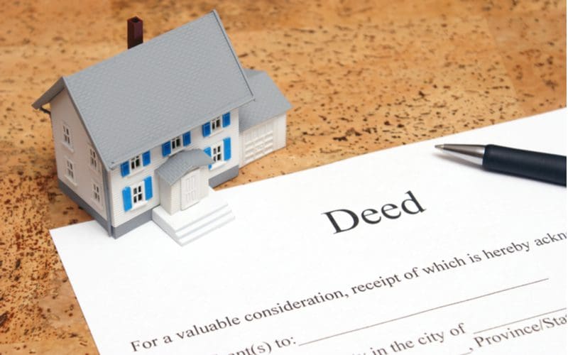
Step 1: Check Your Deed

Matt Benoit/Shutterstock
A good place to start when looking for your property line is the deed to your land. As a binding legal document recording your holdings, a deed should list the exact boundaries of the property in some way.
If it doesn’t, it will refer to a different document that does have those measurements.
If your deed does refer to a different document, it may be slightly out of date. So, it might describe landmarks that no longer exist. If this is the case, you’ll want to check a more up-to-date document.
How easy or hard it is to follow the description to find exact property lines depends on how the legal description was written.
Some legal property descriptions are written simply, detailing the lot’s exact location relative to other lots or structures. Others are more detailed, containing exact measurements of the property lines that can be followed from a reference point.
If yours contains exact measurements, you can use them to walk your property and determine the boundary lines.
As you follow the measurements from the reference point in the legal description, you should come across property line markers, or survey pins, that are either visible or buried at the corners of where your property ends.
Visible markers are certainly easier to locate, but even buried markers can be found with a metal detector’s help.
Please note: Call 811 a few days before you dig for markers to make sure you won’t be digging into buried wires, utility lines, or irrigation systems. Someone from a local utility company will come to your property to mark where any county wires or pipes are located.
Survey pins are markers usually made of steel or iron rebar. You’ll find them buried about a foot below the surface.
With a metal detector, you can follow the legal description measurements as written and check for the presence of metal at the corners where you’d expect the markers to be.
With the location of all utilities and buried wires marked, you can safely dig at the property line corners where your metal detector indicates to be sure a marker is there.
Use a stake or flag to mark each one as you go. This method is great for satisfying curiosity or comparing property line notes from a deed with those of your neighbor.
If there is a legal dispute or you need precise property lines for your lender, title insurer, or building permit, you’ll need to hire a surveyor.
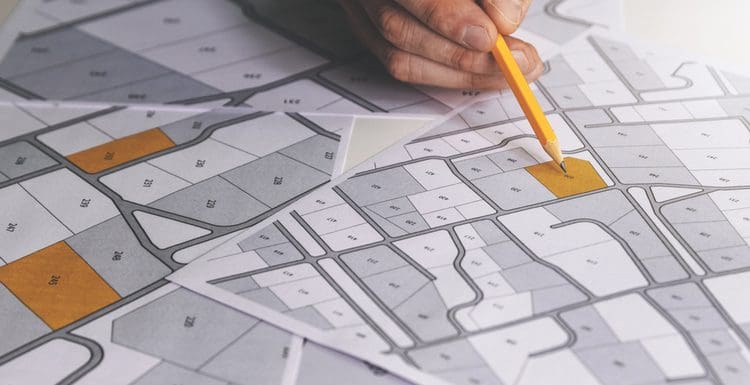
Step 2: Look at Your Plat Map

Lisheng2121/Shutterstock
A plat map, also called a property line map, describes the boundaries of different properties in a certain area while also offering topographical information like elevation, the presence of water, and other long-term structures.
Plant maps are drawn to scale and show:
- Land size
- All boundary and property line locations
- Dimensions of each lot
- Flood zones
- Nearby streets and roads
- Easements and rights of way
- Parcel numbers for lots
There are five different kinds of plat maps, but the ones you’ll need to find your property lines are subdivision and consolidation plat maps.
These show the dividing of a single parcel, or property, into smaller pieces or the uniting of small parcels into larger land groups, respectively. You may also consult amending plats, which show small corrections that have been made.
They’re usually reasonably up-to-date, with some counties renewing them every year. This does change from county to county, though, so be sure to verify that you have the most recent map available to you.
You should have a copy of at least one of these maps in your records. If not, you can request them from your local assessor’s office.
In some cases, you can even request them online. You can usually do this through your local government’s land records, building, or tax department.
Please note: A few days before you plan to dig, you must call 811 to have a local utility company come and mark the location of any utility lines, wires, or irrigation systems that may be buried.
Using the dimensions and boundary line locations from the plat map, you can find the property line markers along the edges and corners of your property. Mark each one as you go to get a complete picture of the boundaries of your property.
It’s important to realize that plat maps, like a deed’s legal property description, are excellent tools to satisfy curiosity but will not be enough to settle a property dispute or meet a lender’s survey requirements.
Plat maps often indicate that the dimensions included are approximate. Additionally, changes and improvements can be made after the plat map is drawn.
For these reasons, you’ll need to hire a surveyor to come and get the exact dimensions and locations of your property lines. We’ll cover this next.
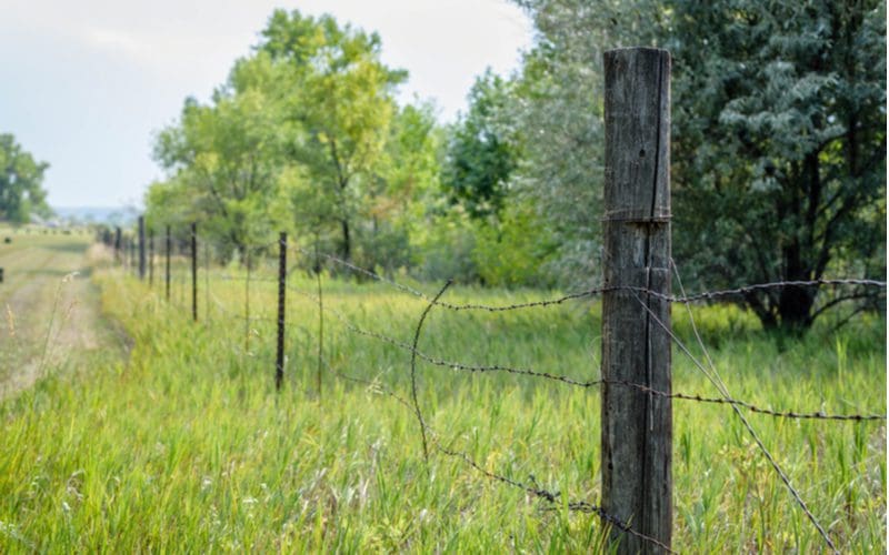
Step 3: Look for Property Markers

J5M/Shutterstock
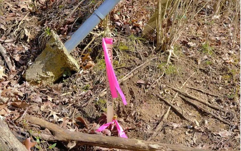
As mentioned above, some properties have obvious landmarks, such as streets or rivers, as their limits. When this is not the case, surveyors will often leave behind artificial marks as a record of where your property ends. These come in two main forms.
The first kind of property marker is a temporary flag. These small, brightly colored flags are designed to be easily spotted and are usually quite fragile.
They are only intended to mark off an area for a short time until a more permanent method is installed. If you’ve had a survey done recently, you may have flags.
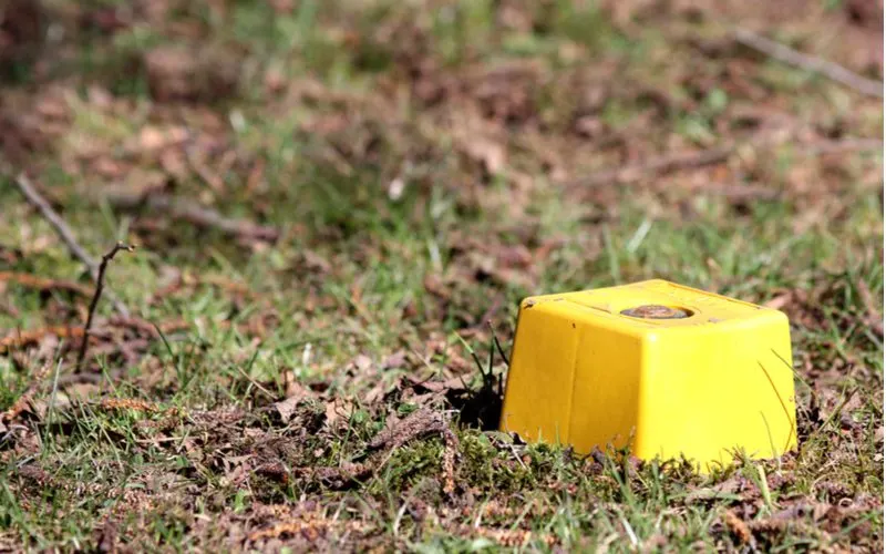
The second kind is permanent markers. Though they can be made of wood or concrete, the most common property markers are metal stakes.
These markers are thicker rods of steel or another durable metal that are driven into the ground and either completely buried or left with a small, colored cap sticking out of the ground.
If you haven’t had a survey done recently, then these are the most likely markers to look for.
Consider going to the likely edge of your property, as designated by your deed and plat map, and using a metal detector to find these markers. Dig down to verify the marker if you can’t see a cap.
Step 4: Get Your Land Surveyed


Sorn340 Studio Images/Shutterstock
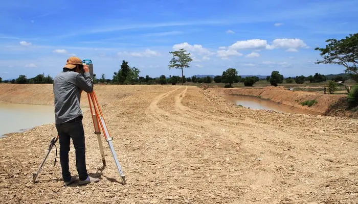
If you’re unable to find any property markers on your land’s edge, then it may be time to call in a new survey. This means contacting a land surveyor, either directly or through your mortgage or title company.
Licensed surveyors are trained to make exact measurements of your property using specialized equipment, basing their surveys on the existing legal information.
These surveyors can either be government-sponsored or hired by real estate companies to assess properties prior to their sale.
Hiring a land surveyor can be relatively expensive. According to Home Advisor, the whole project will cost, on average, between $347 and $680, with higher prices for larger plots of land or more populous areas.
Remember to check that the surveyor you hire is licensed and experienced in working with properties in your area.
This information should be freely available upon request, as all professional surveyors need to pass certain exams and be in good legal standing with your state’s professional board.
Step 5: Keep a Record

RobDun/Shutterstock
Once you’ve determined your property’s borders, be sure to request updated paperwork for your records.
Get an updated survey results record, plat map, and deed, for which you’ll want to consult a legal professional to make sure it’s accurate.
Alongside your land records, you’ll want to keep a copy of your mortgage for the life of your ownership of the property.
If you’ve just moved in, you should keep a copy of the closing agreement for at least a year after closing. These records can be physical or digital, and you should keep a backup as well.
You’ll also want to turn in those updated land records to your local government property agency so that they have them on file.
You may also consider sharing the information you’ve found with your neighbors, especially the results of any surveys, so that they can have an up-to-date record of their property as well.
Things to Consider


DifferR/Shutterstock
In the process of finding your property lines, there are quite a few things to remember. This may be anything from practical methods of finding the lines to legal considerations related to record-keeping.
Consider the following before and during the process:
- Google Earth used to include a feature that showed the most recent property line records. This feature is no longer available, and the information it showed is considerably out of date, making it an unreliable source.
- If you are in the United States, remember to call the national before-you-dig hotline, 811, for information about where underground utilities are buried before doing any digging on your property. They’ll ask for your address and the project you’re planning.
- There are many free apps you can use to see your property lines on your phone. These may not be completely accurate, though, so use them in conjunction with other sources.
- Once you’ve found your property line, ensure that all of your construction is within it. Building a structure like a fence directly on the line can often incur encroachment penalties from your local government.
- There are many other legal considerations to keep in mind about your property line. Some counties restrict projects based on their size and proximity to other properties, while others restrict based on the zoning of the lot. Consult your local law professionals for more information about specific projects you plan to take on.
- If you are considering selling your property, having an up-to-date survey can help you assess the true value of the land. It will also help your and your buyer’s records stay accurate in the case of a dispute.
The Best Way to Find Property Lines

There is no doubt that the best and most accurate way to find property lines is by hiring a surveyor. Yes, it’s a cost you’d rather not pay. However, it could save you thousands (or more) later on.
Whether you’re buying a new home, considering building a new structure, uncertain if a neighbor’s fence or tree is on your property, or just curious about where your property line is, only a surveyor can provide an official report.
- Hiring a surveyor stops property line disputes with neighbors from becoming a legal matter and helps you keep things cordial.
- It reassures you that the new garage or fence you’re thinking of building will be on your own property.
- It prevents you from paying for a new structure that will eventually be ruled as being on a neighbor’s property, requiring you to pay to have it removed.
- It helps you guard your property against being used and eventually acquired by neighbors through an adverse possession law.
- It might even reveal that your lot extends further than you thought.
Consulting your deed and checking a plat map are good options if you just want to know the approximate dimensions of your lot and the locations of boundary lines. But if your lender or title insurer requests a survey, hiring a surveyor is the only way to do it.
If you or your neighbor are nearing (or are already in) a dispute over property lines, only an official survey report can prove your case in court. A surveyor’s updated report is the best and most accurate way to find property lines.